Enjoy this content?
Click to make it sunny!
Introduction
Just like the perfect loaf of bread requires more than simply combinging flour and water, a thunderstorm demands not just the presence, but also the precise choreography of certain ingredients in nature's atmospheric kitchen.
Note from the author:
Whether you’re a weather enthusiast, or someone who simply wants to understand how storms form, this page breaks down some of the science of thunderstorms.
My goal is to help you see each thunderstorm not just as a weather event, but as a carefully crafted atmospheric loaf of bread .-Eric
We’re going to break this page down into several sections, keeping with our recipe analogy. Links provided to each section.
Atmosphere (i.e. a thunderstorm’s “oven” )
how the atmosphere provides the environment where thunderstorms develop
Ingredients (i.e. the “flour, salt, water, yeast” of thunderstorms)
details about Moisture, Instability, Lift, and Wind Shear
Convection (i.e. the “baking” of our storm)
how these ingredients interact through convection
Types (i.e. storm “bread” types)
different types of thunderstorms that result from variations in ingredients and baking conditions
MNCHASER'S ALMOST FAMOUS THUNDERSTORM RECIPE
------------------------------------------------------
Prep time: 1-3 hours
Serves: Everyone within a 10-mile radius

INGREDIENTS:
- 2 cups of atmospheric moisture
- 1 tablespoon of instability
- 1 teaspoon of lifting mechanism
- A pinch of wind shear (add more for severe storms)

INSTRUCTIONS:
1. Preheat atmosphere to unstable conditions
2. Mix ingredients thoroughly in a convective environment
3. Allow to rise until cumulonimbus formation occurs
4. Watch for precipitation when fully baked
Standard Atmosphere
a macro view of our environmentLet’s recall a few principles from the world of physics and the Basice Weather Topics page.
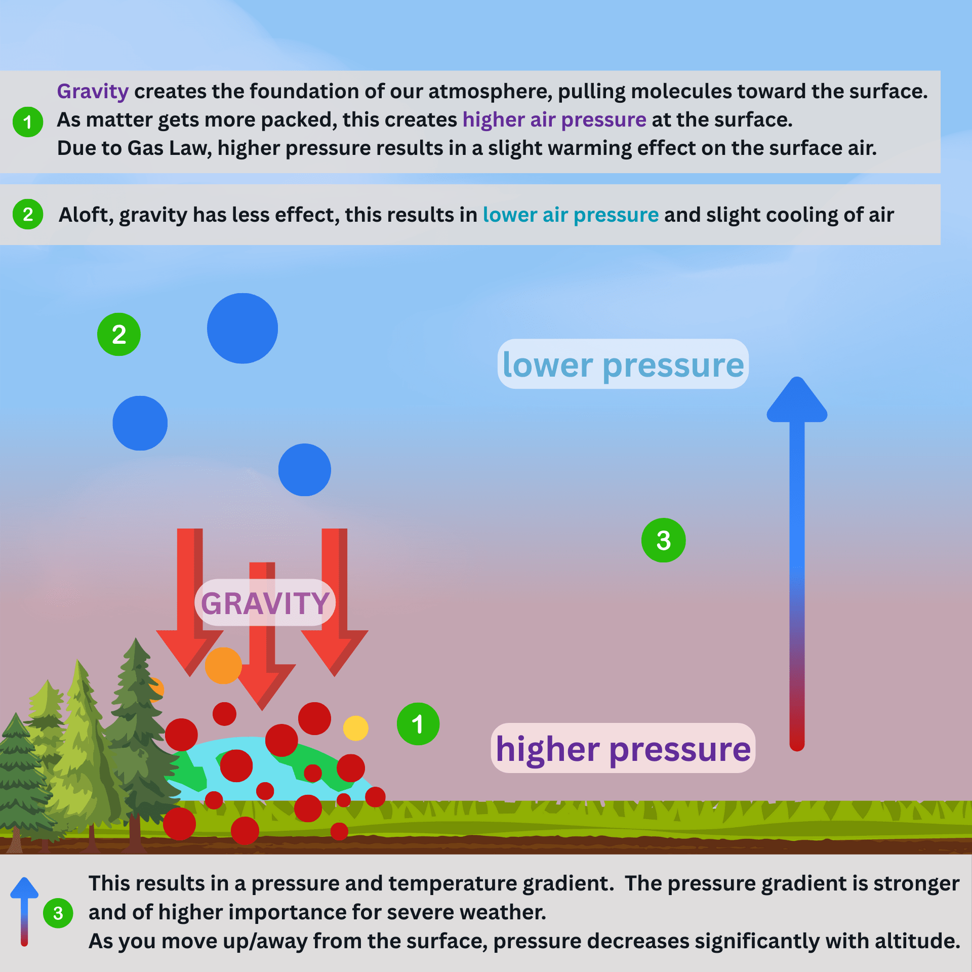
GRAVITY pulls air molecules towards Earth’s center, causing molecules to become more tightly packed. This results in higher pressure air at the surface.
Due to Gas Law , as more molecules are packed into a tighter space, the volume of air will decrease and air pressure will go up. Additionally, molecules begin moving more rapidly and colliding with one another, causing the air to warm slightly.
Further away from the surface, gravity has less effect. Air is allowed to expand, resulting in lower pressure . Less movement and fewer collisions lead to slightly cooler air aloft.
Density and Buoyancy
differences in density create a natural rising forceThe density of an object describes how much matter exists in a given volume . The more matter packed into that object - the greater its density!
- low pressure air is less dense than high pressure air
- warm air is less dense than cool air
- moist air is less dense than dry air
An object that is less dense than its surrounding, will have a natural tendancy to rise in that environment. We call this rising force buoyancy .
Adiabatic Lapse Rates
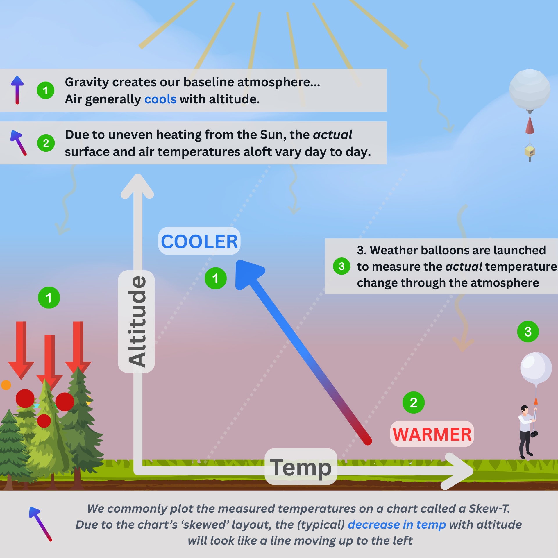
the rate at which air cools with altitudeAs air rises, it cools with altitude due to lower pressure air allowing expansion.
Adiabatic means this change in temperature is solely due to the result of the pressure change, not related to any other exchange of heat with its surrounding, such as radiation.
The Dry Adiabatic Lapse Rate (DALR) describes the rate at which dry air cools. Unsaturated/drier air cools at a rate of exactly 9.8°C/km .
After cools to its dew point, the air becomes saturated (100% relative humidity). At this point, the air begins rising more slowly, at a different rate.
The Moist Adiabatic Lapse Rate (MALR) describes the rate at which saturated air cools. Depending on the overall presence of moisture in the air, the MALR can range from 4°C/km to 9°C/km. The average MALR is typically found between ~6-7°C/km .
The standard atmosphere is considered to have a global average lapse rate of 6.5°C/km
In the standard, idealistic atmosphere, less dense air is always above denser air below it. None of the air has buoyancy and therefore, no support for rising motion exists.
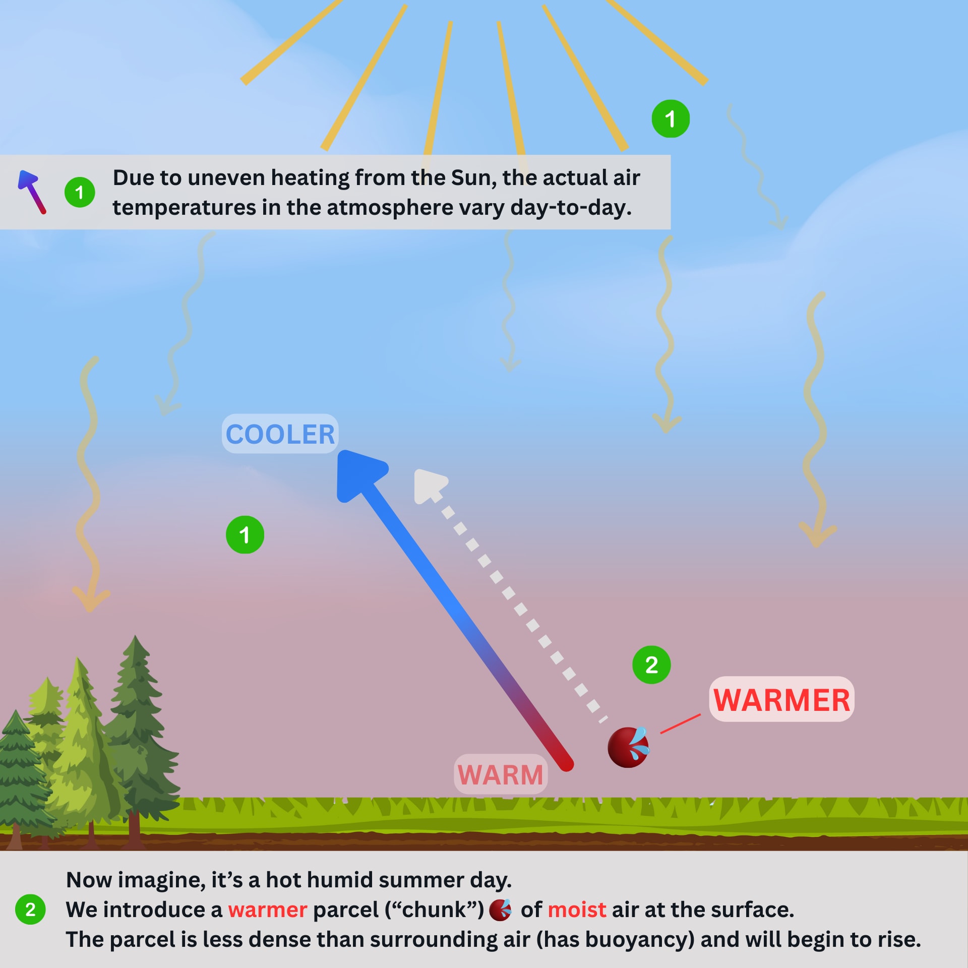
Our atmosphere is rarely as perfect as defined in the previous sections. Air masses of different temperatures are constantly moving around the globe.
Summary
As long as a parcel of air stays less dense than the surrounding air, it will have buoyancy , and it will rise. The greater the difference is between the parcel and atmospheric temperature/density, the faster the parcel will rise.
Ingredients
Mixing the right about of certain ingredientsMoisture
The “flour” of storm bakingFor purposes of this topic, moisture refers to water vapor, the gas state of water. Moisture is arguably one of the moist important ingredients, particularly for severe storm development.
Assuming other conditions are met, having more moisture in the air will support stronger and longer-sustaining updrafts, and can help create deeper (taller) storms and better organization of the storm.
Moisture content is measured numerous ways, but the most common are:
- Dew Point - the temperature at which air becomes fully saturated
- Relative Humidity (RH) - the % of moisture in air, with 100% = saturated
As air cools, the amount of moisture it can hold decreases, therefore the RH% increases.
Instability
The “yeast” of storm bakingAtmospheric Stability is one of the ways we describe the day-to-day atmosphere. Similar to how yeast is more active in warm temperatures, rising air (buoyancy) can be more or less favorable in different atmospheric setups. It is constantly changing, so we need ways to measure it.
Measuring the atmosphere
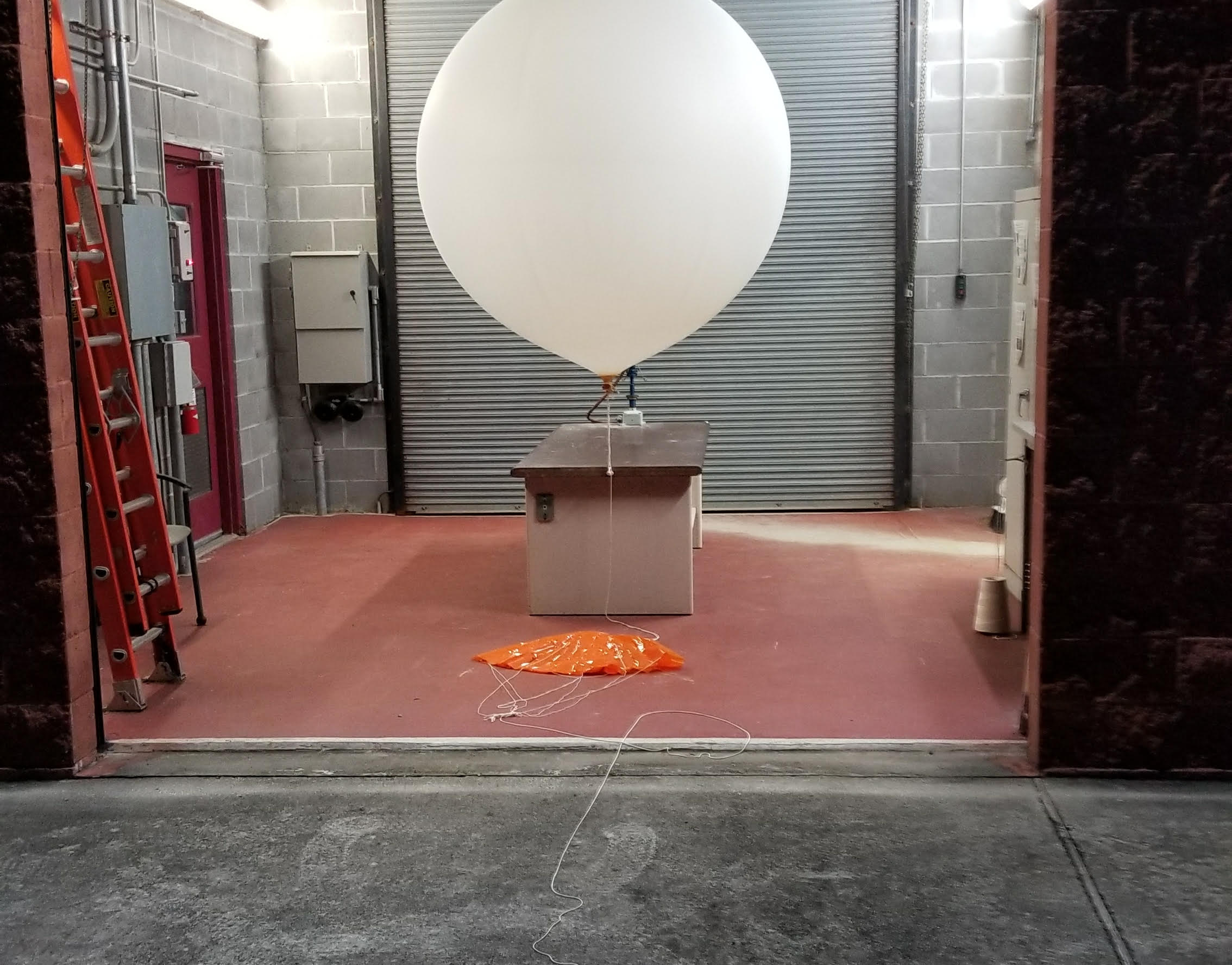
monitoring our kitchen with weather balloonsEvery day, usually twice a day, weather balloons are launched all around the world. Equipped with numerous sensors, they measure things like pressure, temperature, and location…mapping the actual profile of the atmosphere.
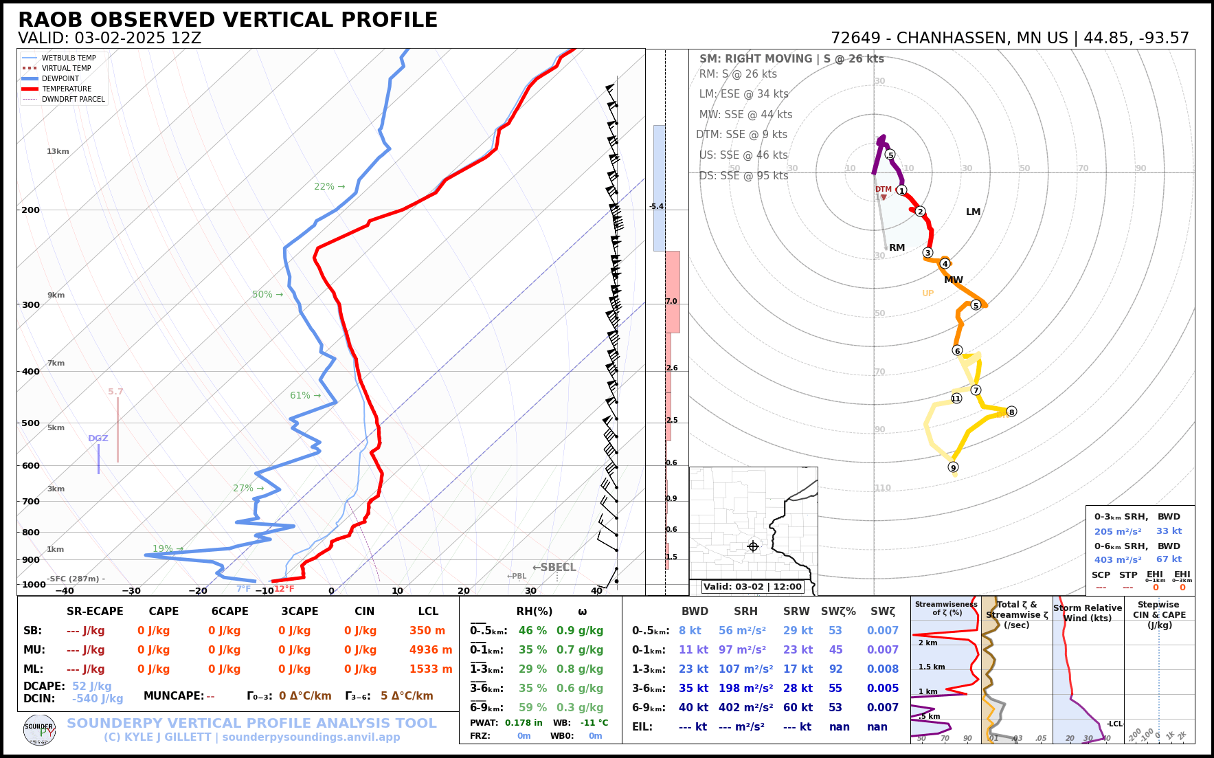
Data from the radiosonde is instantly sent back for analysis and plotted on a sounding .
One of the most important measures from a sounding is temperature - specifically the change in temperature with altitude. YUP! - you guessed it, this helps calculate the actual rate of cooling in that region, the Environmental Lapse Rate .
From these measurements of temperature, relative humidity, and pressure at different heights, the Moist Adiabatic Lapse Rate (MALR) can be calculated as well.
The image below shows a conceptual illustration of our atmosphere and temperature plot on a Skew-T diagram.
Atmospheric Stability
whether the surrounding environment will give an object buoyancyComparing the Environmental Lapse Rate (measured) to the Dry Adiabatic Lapse Rate (DALR) and Moist Adiabatic Lapse Rates (MALR) will tell us if the atmosphere is actually cooling faster or slower than “normal” rates.
We use this comparison to label the atmosphere as either:
- Stable - the environment is not supportive of rising air
- Unstable - the environment is very supportive of rising air
Different parts of the atmosphere can be labeled differently too. For example, the lower portion of the atmosphere can be stable, while the atmosphere above it is unstable. We call this "conditionally unstable" because a certain condition needs to occur first (ex. air needs to be artificially lifted), before the air will rise on its own.
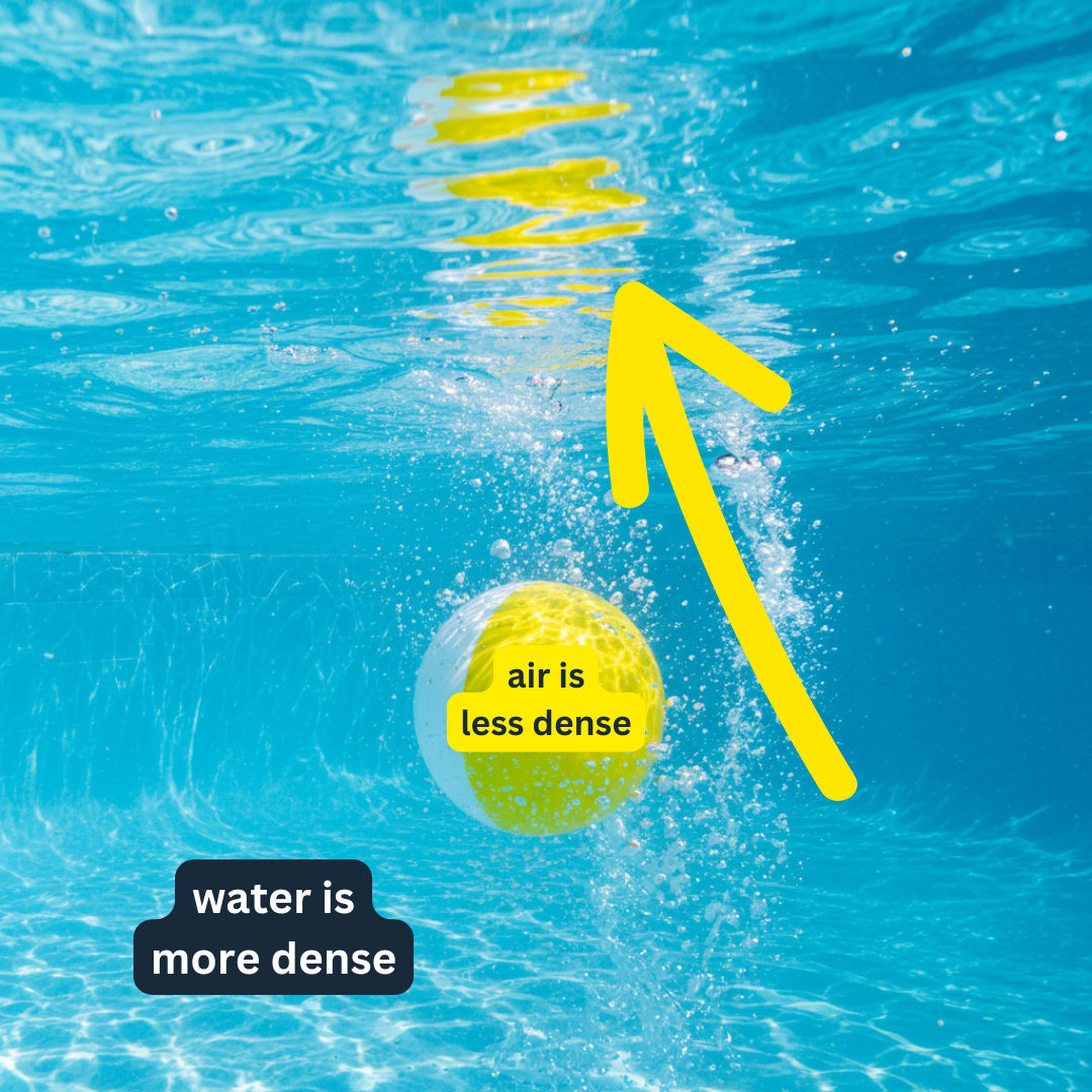
Air can behave the same way as a ball in a pool. If a parcel of air moves into an environment where the parcel is less dense than the surrounding air, the parcel will rise.
Temperature Inversions
When a warm(er) layer of air moves in above us, we call this a temperature inversion because it is the opposite of our standard profile. Temperature inversions create a stable region of the atmosphere and play a major role in preventing air from rising.
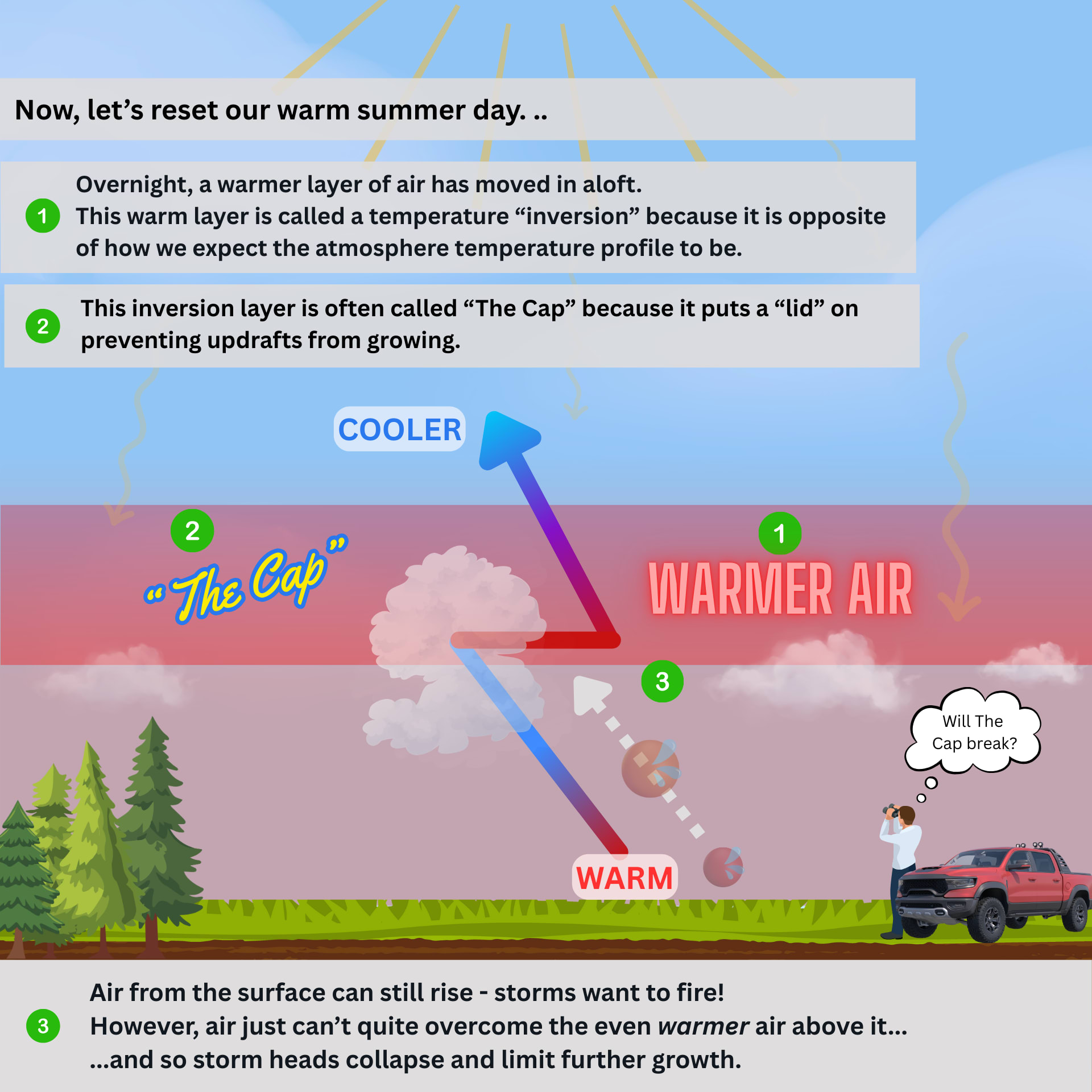
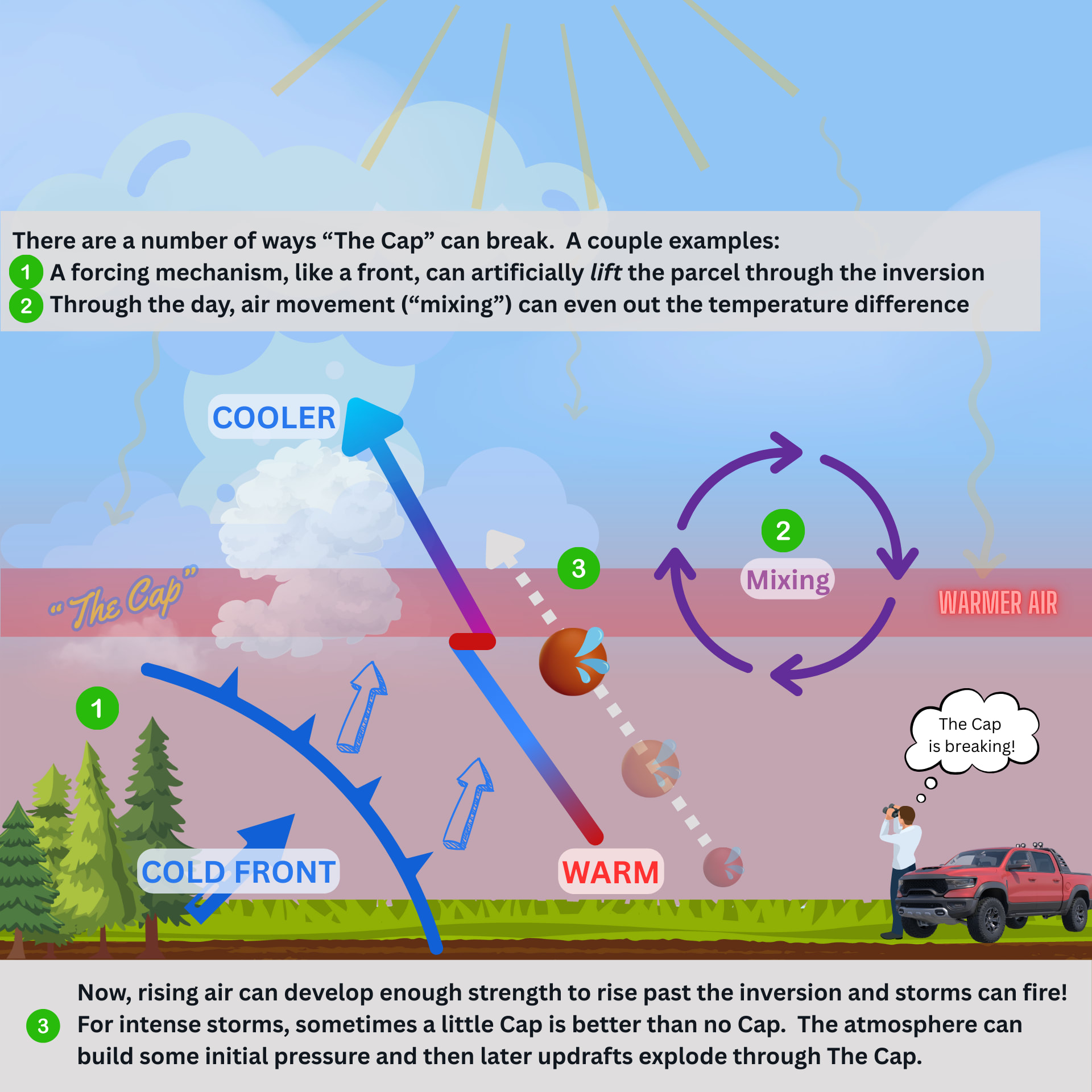
Overcoming Temperature Inversions
Just like jumping into a pool with a ball, it is possible for rising air to overcome a temperature inversion. This can be accomplished in a number of ways, but ultimately resulting in the same thing: making the air parcels less dense than the surrounding air .
Here are a few examples:
- increasing the temperature (warming) air makes it less dense (ex. daytime heating)
- lifting (forcing) the parcel to a higher altitude (ex. a front)
- even-ing out (mixing) the surrounding air to remove the inversion (ex. convection)
Lift
Forcing: the “kneading” of storm bakingLift in meteorology is any process that forces air parcels upward through the atmosphere. Without lift, even the most moisture-laden, unstable air would remain dormant…just like dough left unmixed on the counter.
Lift is the active force that sets everything in motion.
Just as a baker must knead dough to activate the yeast, thunderstorms require a lifting mechanism to transform and move their raw ingredients into the right place to initiate storm development.
Lifting:
- Pushes moisture-rich air upward where it can cool and condense
- Activates the potential energy stored in unstable air
- Creates the vertical structure necessary for thunderstorm development
Types of Lift
Different Kneading TechniquesJust as bakers employ different kneading techniques, the atmosphere uses several mechanisms to lift air:
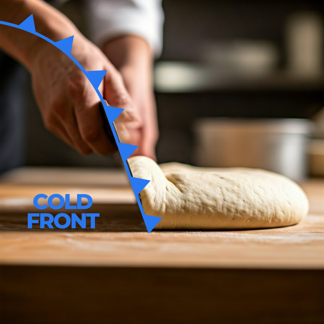
Frontal Lifting - When a cold front approaches, it acts like a bench knife, forcefully sliding underneath warm air and lifting it off of the surface. The cold front creates a sharp, well-defined lift — often producing strong, organized thunderstorms.
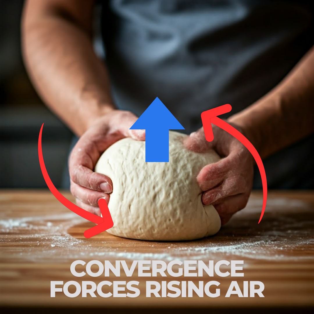
Convergence When surface winds flow together (converge), they have nowhere to go but up—similar to how dough stretches up in the center when the sides are pulled in. Surface Low Pressure systems, urban heat islands, and sea breezes create convergence zones where thunderstorms can develop.
Orographic Lifting When moisture-laden air encounters a hill or mountain range, it has no choice but to rise, cool, and potentially form thunderstorms on the windward side. This is nature’s most reliable kneading technique, creating predictable “mountain-baked” thunderstorms.
Convective Lifting Once the initial lifting begins, the process can become self-sustaining through convection (we’ll discuss more in the next section). As air parcels are lifted and warmed, they continue rising through buoyancy, creating powerful updrafts that form the backbone of mature thunderstorms.
The Perfect Lift
The strength and type of lift directly influence the character of the resulting thunderstorm.
- Gentle / persistent lifting (like slow, patient kneading) often produces widespread, moderate thunderstorms.
- Intense / focused lifting (like vigorous kneading) can create severe, explosive thunderstorm development.
For the most powerful thunderstorms, multiple lifting mechanisms often work together. A cold front intersecting with mountains during peak daytime heating provides the perfect “kneading” combination for spectacular storm development.
When Lift is Lacking
Without sufficient lift, the other thunderstorm ingredients remain unused potential. You might have abundant moisture and instability -like having the finest flour and most active yeast— but without the kneading action of lift, your atmospheric dough will never rise and define a thunderstorm.
Vertical Wind Shear
Organization: a master baker’s discipline to “technique”Vertical Wind Shear is the change in wind speed and/or direction with height in the atmosphere.
A master baker knows that, once you have the right ingredients, it is technique that separates that dough’s future…becoming a pancake or an artisanal masterpiece. For this reason, wind shear is more of a multiplier than an ingredient because it transforms ordinary thunderstorms into complex, long-lasting weather systems.
As vertical wind shear increases, thunderstorms often evolve from simple cells into “multicells” or the most impressive of all: “supercells”.
Common sub-categories important to storm development
- Speed Shear : ex. winds are 10kts at the surface and 50kts at 18,000 ft above ground.
- Directional Shear : ex. winds from the south at the surface, but from the west aloft
- Low-Level Shear : shear in the lowest parts of the atmosphere (critical for tornado formation)
- Deep-Layer Shear : shear throughout a deep layer of atmosphere (critical for overall structure)
Benefits of Vertical Wind Shear
it’s all about structureOne example of a benefit that wind shear brings, it creates a tilted structure in a storm.
Tilted Storms
A tilted thunderstorm displaces the updraft from the downdraft. This separation allows the updraft to sustain itself for a longer period. A storm can continue drawing in warm, moist air without being smothered by its own rain-cooled downdraft.
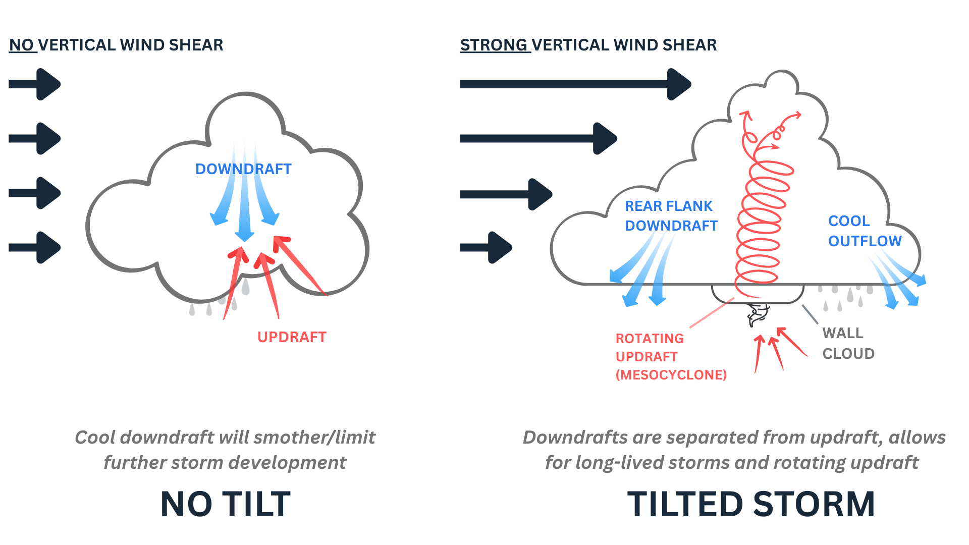
When shear is…weak
Without significant wind shear, thunderstorms remain simple and short-lived. The downdraft (falling cool air and precipitation) quickly smothers the updraft (rising warm air), cutting off the storm’s fuel supply. These ordinary thunderstorms, while impressive, typically last less than an hour and rarely produce sustained severe weather threats (flooding, hail, wind, tornadoes, etc.).
Convection
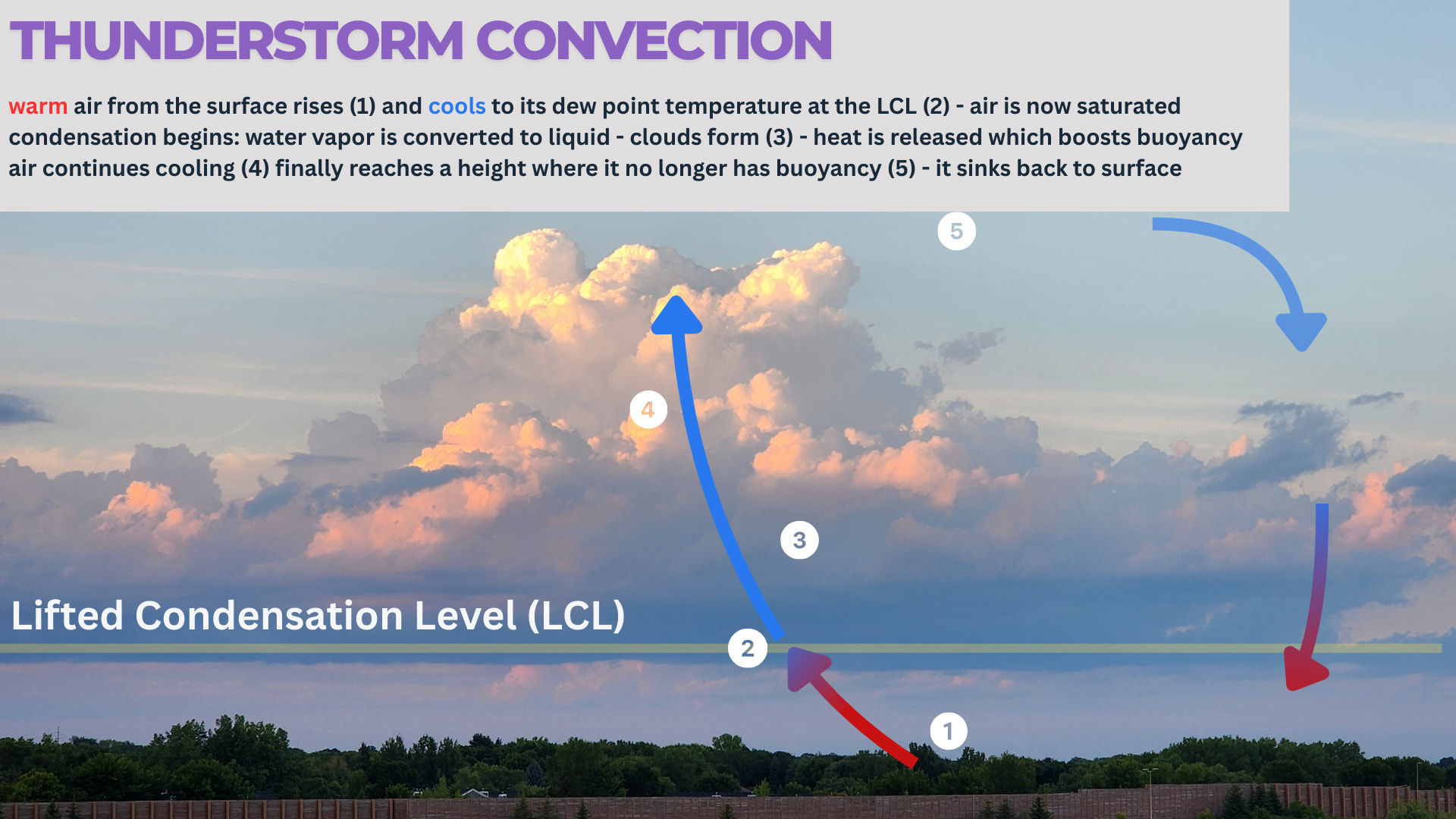
Circular air movement in nature’s thunderstorm “oven”Convection = the vertical movement of air (up AND down) due to temperature differences.
Convection is the nature’s way of redistributing heat and energy throughout the atmosphere, and it follows a predictable pattern:
- Heating Phase : Surface air warms, typicallly radiation from the surface
- Rising Phase : Warm air begins to rise through the atmosphere
- Cooling Phase : As air rises, it expands and cools
- Condensation Phase : Cooling air reaches its dew point, forming clouds
- Precipitation Phase : Water droplets grow and eventually fall as rain
- Downdraft Phase : Falling rain and cooled air create downdrafts
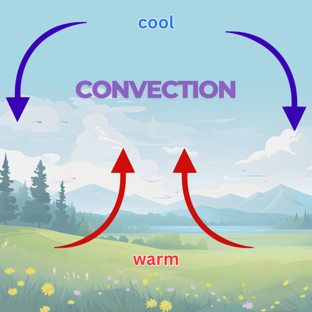
Convection is fundamental to our weather and drives everything from gentle cumulus clouds to violent thunderstorms.
Condensation
Making clouds and hitting turbo on updraftsCondensation is perhaps the most visually dramatic part of the convective process — the moment when invisible water vapor transforms into visible clouds and precipitation.
When rising air cools to its dew point temperature, water vapor condenses onto tiny particles forming cloud droplets. But, arguably more important to thunderstorm development: condensation also releases latent heat
The released latent heat acts like adding turbo to the convection process by re-warming the surrounding air, preveting it from becoming too cold/dense, causing it to rise even faster and higher.
This also explains why the Moist Adiabatic Lapse Rate (MALR) is slower than the Dry Adiabatic Lapse Rate (DALR) i.e. condensing moist air self-warms = rises slower
Lifted Condensation Level (LCL)
The height at which this condensation typically occurs is called the Lifted Condensation Level (LCL) , and it forms the flat base we often see in cumulus clouds.
Precipitation
Finally, as condensation continues within the updraft, water droplets grow larger and larger. Eventually, they become heavy enough that the updraft can no longer support them, and they fall as precipitation.
Besides just making things wet, precipitation (and cool downdrafts) play an important role in storm maintenance: regulating the storm, preventing it from getting out of control, and supporting longevity.
Convective Available Potential Energy (CAPE)
We can quantify the potential for convection using a measurement called Convective Available Potential Energy (CAPE) .
CAPE is calculated from temperature and moisture profiles measured by weather balloons or estimated by computer models. Higher CAPE values indicate greater potential for strong updrafts and severe thunderstorms.
CAPE essentially measures the “fuel” available for our convective “engine”.
What makes CAPE particularly useful is that it integrates both temperature and moisture information, giving forecasters a single value that represents the atmosphere’s convective potential.
Convective Inhibition (CIN)
While CAPE represents the potential energy available for convection, Convective Inhibition (CIN) represents the “barrier” that must be overcome before that energy can be put to use.
CIN typically occurs when a layer of warm air sits above cooler air near the surface, preventing air parcels from rising freely.
HEY! We know what that is! That’s a temperature inversion , or “The Cap” .
Think of CAPE as the fuel in your car’s tank, while CIN is like having your foot on the brake. Even with a full tank (high CAPE), your car won’t move if the brake (strong CIN) is engaged.
Similarly, thunderstorms may not develop, even with high instability, if there’s significant convective inhibition somewhere above.
Breaking through this inhibition requires some form of lifting mechanism – such as a cold front – to force air parcels through The Cap.
Once air parcels break through this inhibition layer, they can access the available CAPE and accelerate rapidly upward, potentially developing into thunderstorms.
Thunderstorm Types
Different types/modes of storms and their behaviorsSingle Cell
Short-lived (30-60 minutes) Simple structure with one main updraft/downdraft cycle Limited organization Typically forms in environments with minimal wind shear
Single cell thunderstorms are the atmosphere’s quick bread—simple, relatively fast-forming, and quick to dissipate. They develop when surface heating creates enough buoyancy for air to rise, but without the wind shear needed for complex organization [3].
While capable of producing brief heavy rain, lightning, and occasionally small hail, their self-limiting nature means they rarely sustain severe weather.
The downdraft quickly cuts off the storm’s updraft, effectively “smothering itself” and ending the storm’s lifecycle.
When to expect them: Hot summer afternoons, particularly in humid environments with light winds.
Multi-Cell
Longer duration (several hours) Cluster of cells in different development stages Moderate organization with new cells continuously forming Requires moderate wind shear
Multicell storms are the atmospheric equivalent of layer cakes—more complex, longer-lasting, and built from multiple components working together.
These systems consist of several thunderstorm cells in various stages of development, with new cells forming as older ones dissipate.
The moderate wind shear tilts the storm structure, allowing updrafts and downdrafts to coexist without immediately canceling each other out.
This organization enables multicells to produce more significant hazards, including strong winds, hail, heavy rainfall, and occasionally weak tornadoes [6].
When to expect them: Ahead of cold fronts or along outflow boundaries from previous storms.k
Supercell
Long-lived (4+ hours) Single, powerful rotating updraft (mesocyclone) Highly organized structure Requires strong vertical wind shear
Supercells are the meteorological equivalent of an award-winning sourdough.
These storms feature a deep, persistently rotating updraft called a mesocyclone, which gives them remarkable longevity and power.
The strong wind shear creates a perfectly balanced storm structure where updrafts and downdrafts work in harmony rather than conflict.
This exceptional organization makes supercells the most likely thunderstorm type to produce extreme weather, including large hail, damaging winds, and strong tornadoes.
When to expect them: During severe weather outbreaks, particularly in the Plains states during spring and early summer.
Storm Recipe
I’m wrapping up this page with my own storm recipe aka “here’s what I look for” when analyzing/forecasting storm potential.
MNCHASER'S ALMOST FAMOUS THUNDERSTORM RECIPE
------------------------------------------------------
Prep time: 1-3 hours
Serves: Everyone within a 10-mile radius

INGREDIENTS:
- moisture (typically > 55°F dewpoints)
- instability (minimally > 1000 J/kg, > 2500 J/kg for severe)
- lifting (e.g. cold front or dry line)
- shear (Bulk Wind Shear)
  - 0-6km: 30-40kts = organized storms
  - 0-3km: 25-35kts = organized storms
  - 0-1km: 15-25kts = greater tornado potential
- rotational shear (Storm Relative Helicity)
  - 0-1km: 100-150m2s2 = moderate tornado risk
  - 0-3km: 150-250m2s2 = moderate mesocyclone/tornado risk

INSTRUCTIONS:
1. Preheat atmosphere to unstable conditions
2. Mix ingredients thoroughly in a convective environment
3. Allow to rise until cumulonimbus formation occurs
4. Watch for precipitation when fully baked