HIGHLIGHTS
- tornado
- hail
- funnel
Enjoy this content?
Click to make it sunny!
Introduction
Our first chase of 2025 is in the books, and this one did not disappoint!
Setup
Forecast
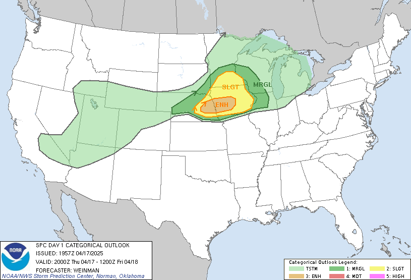
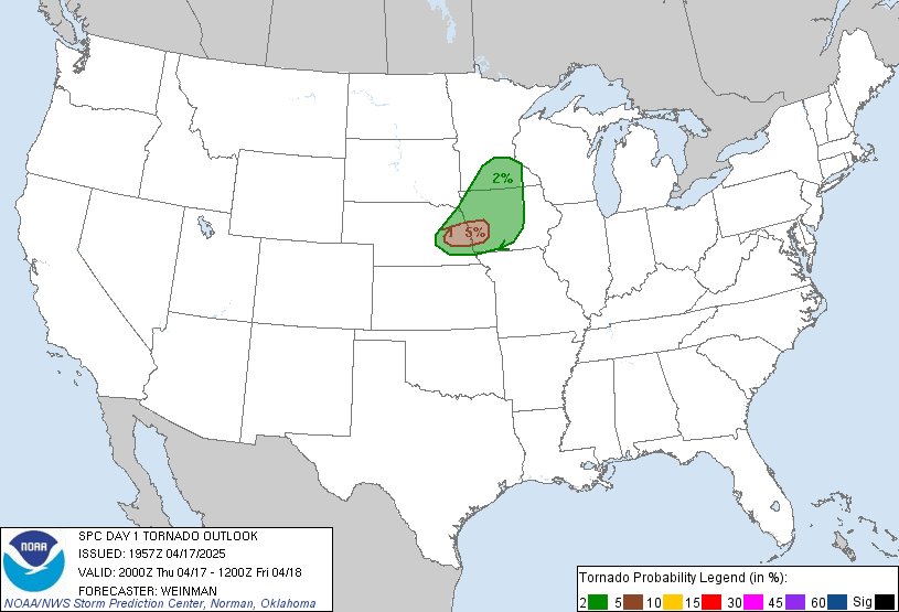
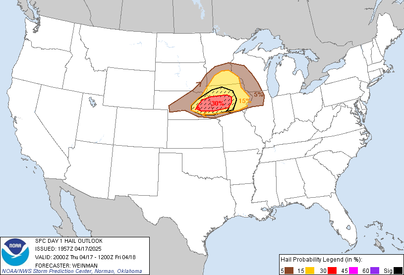
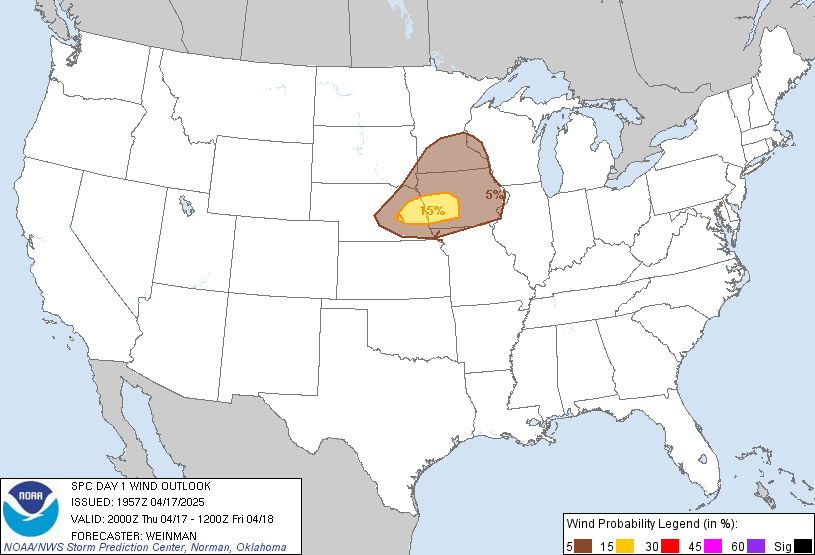
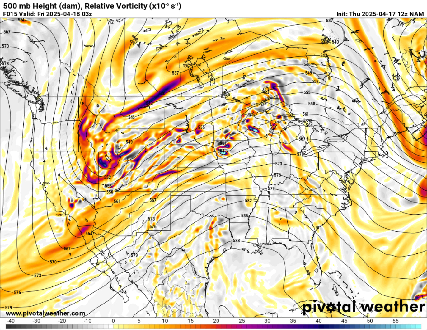
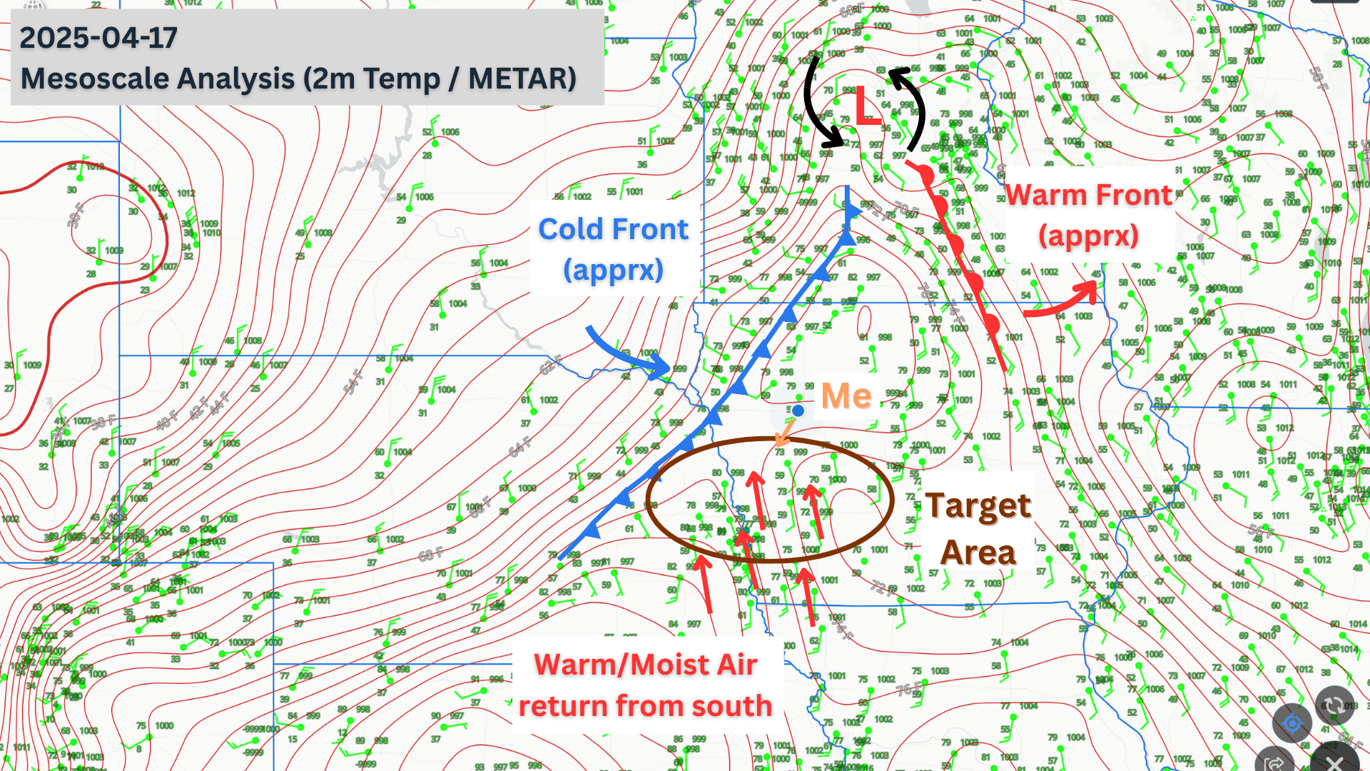
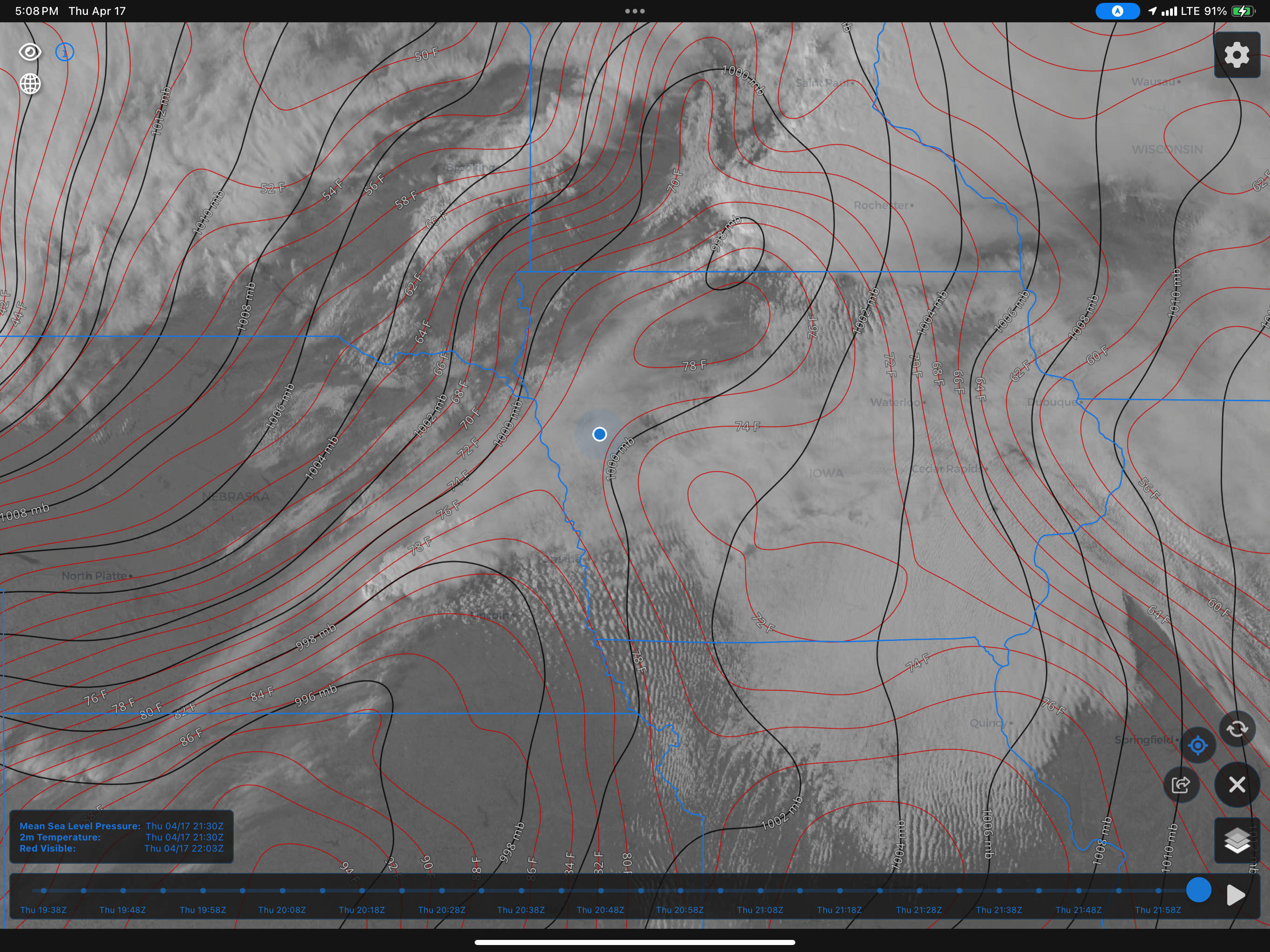
Ahead of a large trough making its way out of the Rocky Mountains, a mid-level shortwave was pushing a surface low across the Central Plains and into MN. An area of unstable air, was developing south of the surface low, extending down to the Iowa/Missouri border. Good moisture flow from the south, set up dewpoints into the 60’s. To the west, an approaching cold front was timed to arrive near Omaha during peak daytime heating. All of this was enough to warrant the Storm Prediction Center to issue an Enhanced Convective Outlook by the morning of.
Chase Plans
Working a full-time job (priority) and having storm chasing as a hobby, often makes for quick (late) decisions to leave and long-night (early morning) drives. This trip was no different.
I had some work things to complete before the end of day Thursday, which meant leaving early was not an option. The trip was also complicated by a stop we had to make in Mankato which would us back another 45 minutes in the itinerary.
Regardless, the target region was clear. A section just west of Omaha - extending east into Central Iowa. …conditional based on clearing of stable air just above the surface (preventing convection) and the timing of the front.
Chase Day
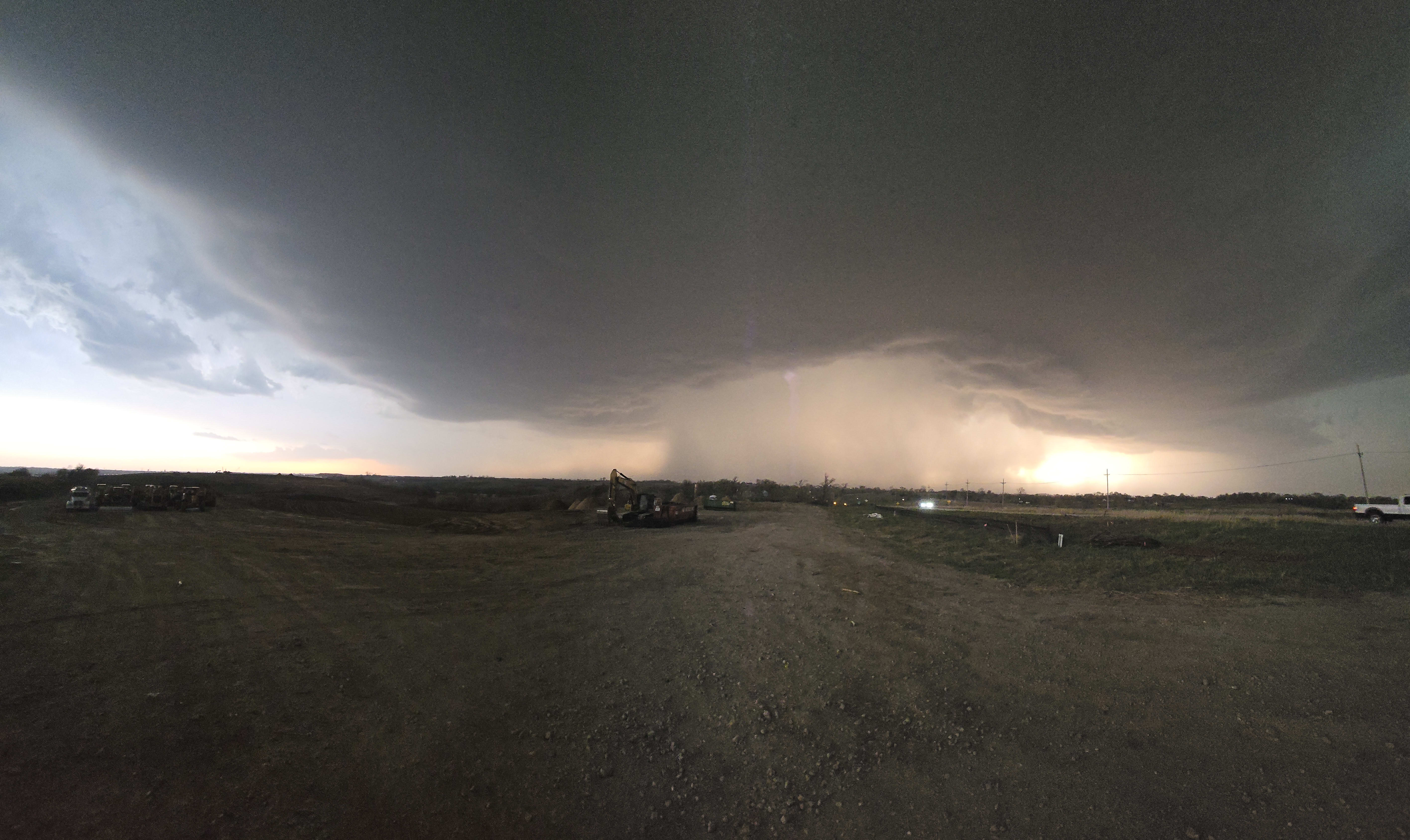
Similar to our Battle Creek, NE chase, we set out with Onawa, IA as a destination to regroup and game plan a further western or southern progression based on storm development. Timing for the arrival of the cold front was predicted around 5:00-5:30.
Well, we didn’t even make it that far! The cold front was slightly ahead of schedule and we started to see initiation west of Omaha beginning around 4:00pm! We were near Storm Lake, IA - putting us over 2 hours away from Omaha.
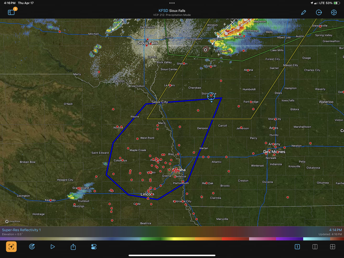
Many times these storms take 45 minutes to mature, and the first storm isn’t always the only tornado producer. So, other than some anxiety about missing out, it didn’t change our plans. Get to Onawa!
By the time we reached Onawa, three distinct storms had developed along the cold front. We stopped for gas and a quick strategy. No sooner did we return to the vehicle, we discovered the northern storm had been tornado warned. We could see clearly defined rotation within Velocity and Spectrum Width products.
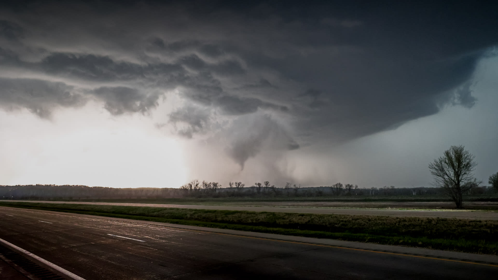
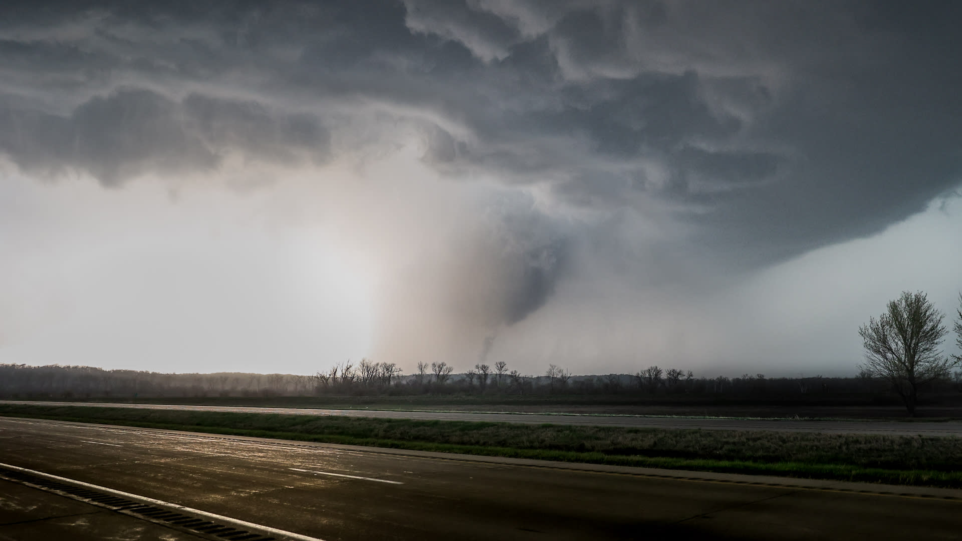
We crossed the Missouri River and headed south along Hwy 75. Not long after, we saw the confirmed tornado reported with “our” (northern) storm. Now, we knew we were actually behind - or missed altogether.
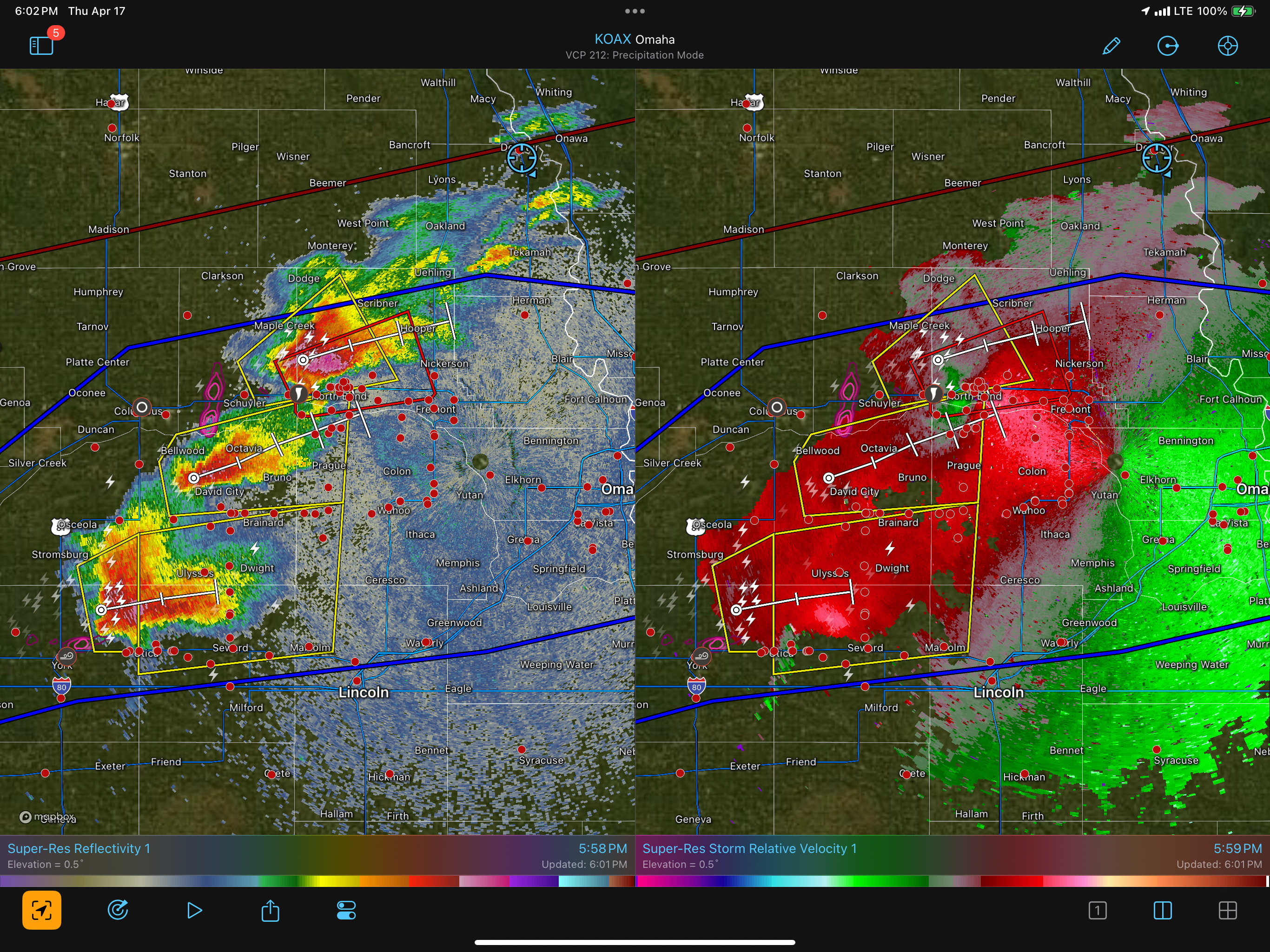
By this time, we were just ahead of the northern storm’s outflow, with storms tracking almost due east. The strategy shifted to: stay ahead of the storm and avoid a rogue 2”+ hail stone!
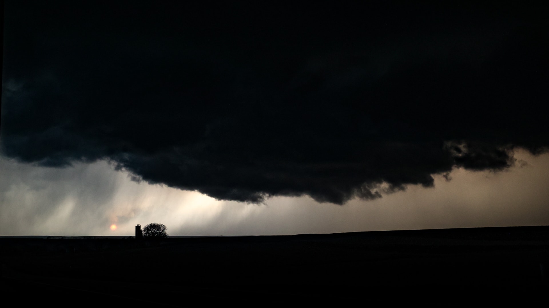
After arriving in Blair, NE…we pivoted slightly west, but continued south on Hwy 133. To avoid Omaha proper, we opt’d for Hwy 36 and headed east towards the Missouri River.
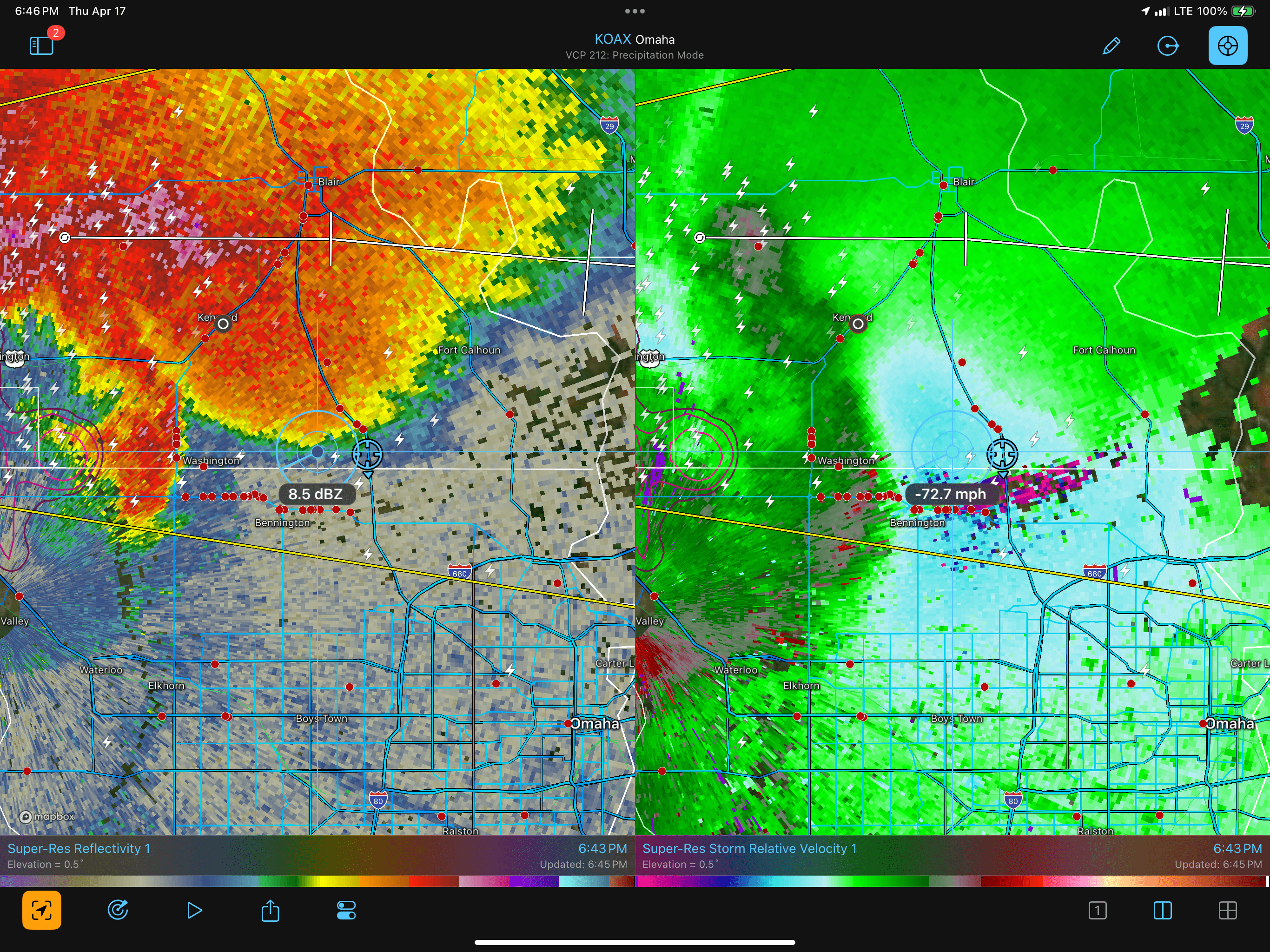
We were now back on track with the storm and managed to get a couple pictures along the way. We were fortunate to capture one of the brief tornadoes, just before the storm crossed the river!
Photos
Wrap up in Greenfield
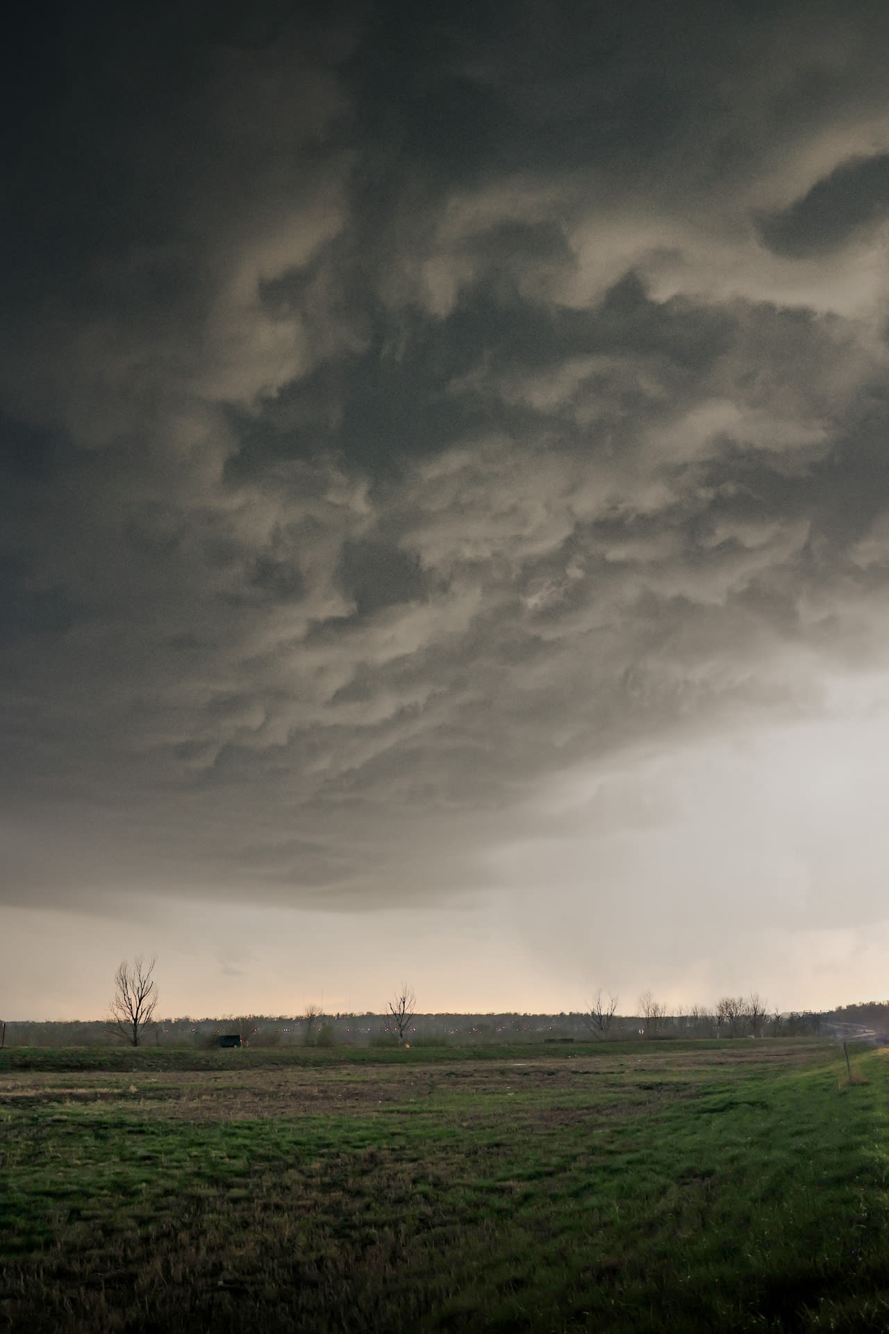
We hit a point of darkness and realized our northern storm was weakening. The southern storm was still kicking strong, but a bit too far of a drive out of our way.
We drove ahead of the storm, making our way to Des Moines for the night. We stopped in Greenfield, IA to see how the city was coming along after last year. The debris was cleared, many new houses were up, but the memories of that day were still fresh. I spent some time talking to my son about that day, being one of the first chasers there after the tornado passed, the damage to homes and lives… It’s a reminder of the respect these storms deserve and how everything can change in a few moments.
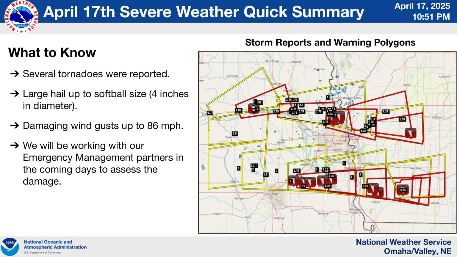
Storm Reports